

|

|

|

|

|
 | ||||
|
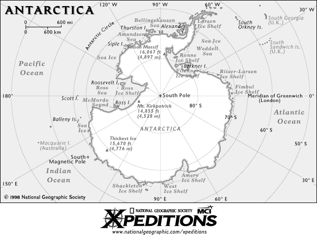
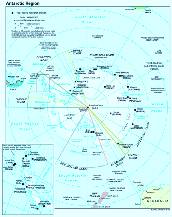
The shape of Antarctica and its relationship to the other continents is a mystery to many people. Likewise, the map below does not follow conventional cartography methods of placing "North" at the top of the map. Oddly, you need to travel south to reach the South Pole, but once there, no matter in which direction you leave, you will be heading north. As time permits, I will be adding individual detailed maps of the heroic expeditions of the past.   Byrd I Expedition Map: 1928-30 [84K] Byrd II Expedition Map: 1933-35 [83K] Byrd III: USASE 1939-41 East Base Operations [74K] Byrd III: USASE 1939-41 West Base Operations [73K] Lincoln Ellsworth's Transantarctic Flight of 1935 [90K] Ronne Antarctic Research Expedition 1947-48 [94K] Operation Windmill 1947-48 [100K] Peri - Antarctic Islands Map [21K] More Maps will be coming on Scott, Amundsen, Shackleton, Filchner, Nordenskjöld, Charcot, and de Gerlache to mention a few. [Previous] Antarctic Philately Home Page [Next] Antarctic Philately Home Page [Home Page] Antarctic Philately [Contents] Antarctic Philatelic Website Contents |